Post #3
PUTTING IT IN PERSPECTIVE II
(Based on presentation to OCL by Dennis Connors, history curator, Onondaga Historical Association)
How the Interstate Highway System Divided Syracuse
It’s ironic that a city that was so vocal and concerned in 1927 about the possibility of an elevated railroad line creating a hostile barrier could allow one to be built between its downtown and its major educational and medical institutions 30 years later. What happened? Where was civic planning?
Note that I-81 and the entire national interstate highway system were a part of post-World War II planning system to provide for fast ground transportation as a military advantage. The National Interstate and Defense Highways Act of 1956 authorized the biggest public works project in the nation’s history, and completely altered the course of America’s urban development, which would thereafter be based on the automobile. The roads had economic implications for the communities with easy access to these interstates, contributing to the growth to new areas, and shifting focus away from the local thoroughfares they replaced.
The NYS Thruway had avoided going through urban areas when it was complete in the 1950’s. That led some local business interests to complain that the road moved business away from the city center.
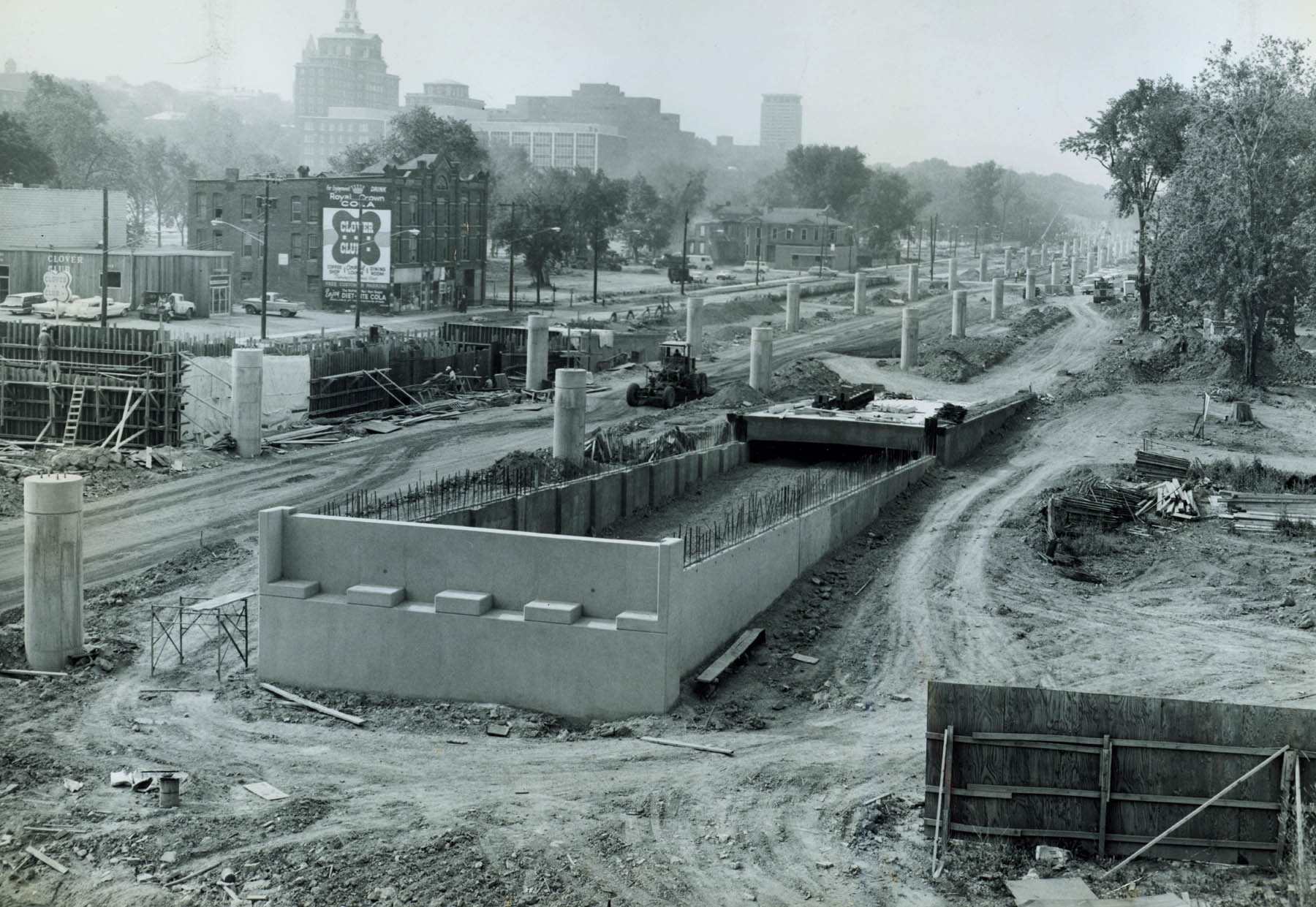
The north-south highway that became I-81 was previously intended to follow Townsend Street through downtown. Earlier (late 1940s) a boulevard that would run along Townsend had been conceived to relieve traffic congestion but the city didn’t have the money to construct the road. Ten years later, the federal government appeared with funding for the highway system and the idea of an arterial/elevation evolved.
 Syracuse’s Mayor Henninger opposed the elevated highway, seeing it as an ugly wall dividing downtown. According to an article in The Post-Standard of April 13, 1958, Mayor Henninger praised the newspaper for bringing to the light the fact that the state had been developing plans for an elevated highway through the city, apparently without any word to the public, and the mayor expressed surprise at the extent of the plans. Most city leaders were “definitely opposed to such a plan”, agreeing with the mayor who said such highways “have ruined other cities.”
To counter the state’s plans, the mayor proposed a depressed highway which would run underneath a civic plaza near today’s Everson. The state opposed this, citing concerns about drainage and cost and the city backed down. The proposed elevated corridor was moved east from Townsend to Almond Street, farther from downtown. There the highway would only encounter what was considered substandard housing, most of which was to be demolished under Urban Renewal. At the time, the late 1950s, downtown Syracuse still had a bustling economy and a link with the University was not a major concern. Downtown business and retail interests could not foresee the benefits of a connection to the expanding institutional complex on the Hill.
The city was promised an “artistic and beautiful” elevated highway, not a wall, but an open system of trestle construction compared to the elevated highway along Boston’s waterfront, then under construction (and of course now replaced by a tunnel to reconnect the city and the waterfront). By 1967 Syracuse newspaper editorials were already calling the elevated highway an eyesore, pleading for “… landscaping and beautification of the unsightly route 81 elevated highway and other elements of the ugly Onondaga Interchange now nearing completion in the heart of Syracuse.” And from a transportation standpoint, in 1973 the Syracuse Herald-American called Route 81 through Syracuse a “multi-million dollar mess” and blamed it on “poor planning.”
Ultimately the forced compromise of an elevated I-81 though Syracuse came down to lack of public input, the community’s inability to enact a local vision, and an incomplete grasp of the long term implications of an elevated highway.
