SEATTLE’S ALASKAN WAY VIADUCT – Part I
The future of an earthquake-damaged viaduct remains undecided
How do you replace an unsafe elevated highway when no one likes the alternatives? That problem has been plaguing the city of Seattle. In 2001 an earthquake damaged the Alaskan Way Viaduct, a 1.4 mile section of Highway 99 that divides Seattle’s downtown core from its waterfront. What seemed an opportunity to redefine the city’s transportation system and to link two vital neighborhoods that are divided by the viaduct became mired in divisive politics. Conflict led to a public referendum in March 2007, giving Seattle citizens a choice between rebuilding an elevated highway and constructing an underground tunnel. Residents voted “no” to both.
Ranked #1 on the Congress for the New Urbanism’s “Freeways Without Futures” list, the Alaskan Way Viaduct is a major regional route into Seattle, carrying about 105,000 vehicles a day. The highway was built on fill, so the underground piles have become a problem, and the seawall that hold up the highway is also deteriorating.
After last year’s unproductive referendum, the Seattle City Council called for the Seattle DOT to develop an Urban Mobility Plan – a systems approach, including surface road, transit and other improvements – to replace the highway capacity. Tom Brennan, a native Central New Yorker, is a Portland, Oregon-based transportation consultant, whose firm Nelson/Nygaard, is currently working with the City of Seattle. N/N is developing the Urban Mobility Plan, part of the Center City Seattle Access Strategy – strategic transit service and surface street grid improvements and demand management strategies that together would absorb the current traffic on the viaduct.
In a presentation to the Rethinking I-81 Study Committee, Brennan explained that even before the earthquake damaged the elevated freeway, environmental issues, energy concerns, and growth projections were forcing Seattle to take a comprehensive systems approach to moving people and goods to and through downtown. The Vice-Chair of the City Council’s Transportation committee put it this way: “The replacement of the viaduct is a fantastic opportunity to begin the creation of a 21st century transportation system. The car can no longer rule all our decisions. There’s got to be a better way.”
In early 2008, the governor of Washington State declared that the damaged viaduct will be torn down in 2012, no matter how much or how little has been done to create an alternative solution. The city, county and state are again looking at the alternatives, agreeing that “the core elements of any solution must address issues such as vigorous public transit, freight mobility, business disruption, urban design, job creation, the preservation of our marine economy and the future of Seattle’s central waterfront” in addition to the fundamental safety, capacity and financial responsibility criteria. In June 2008, the State DOT released eight proposals for a new roadway, including boulevard, elevated viaduct, underground tunnel and cut-and-cover tunnel alternatives. A retrofit of the existing viaduct is not an option. The proposals were presented to stakeholders on September 25. A decision is due at the end of the year. According to the Seattle Times, however, costs could eliminate some plans. The State originally had a $2.8 billion budget, but has spent nearly half of that on work to stabilize the existing viaduct.
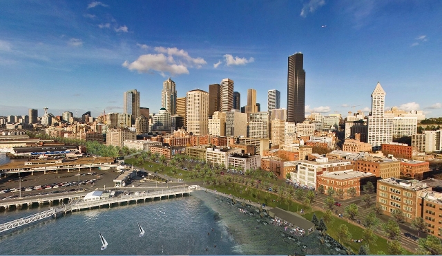
Photos: Alaskan Way Viaduct and Proposed Surface Alternative
Courtesy People’s Waterfront Coalition


