Author Archives: OCL

Claiborne Expressway, NOLA: CNU Freeway Without a Future #3

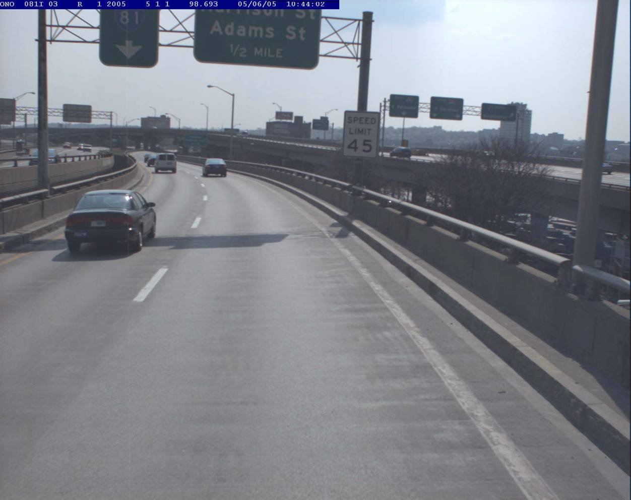
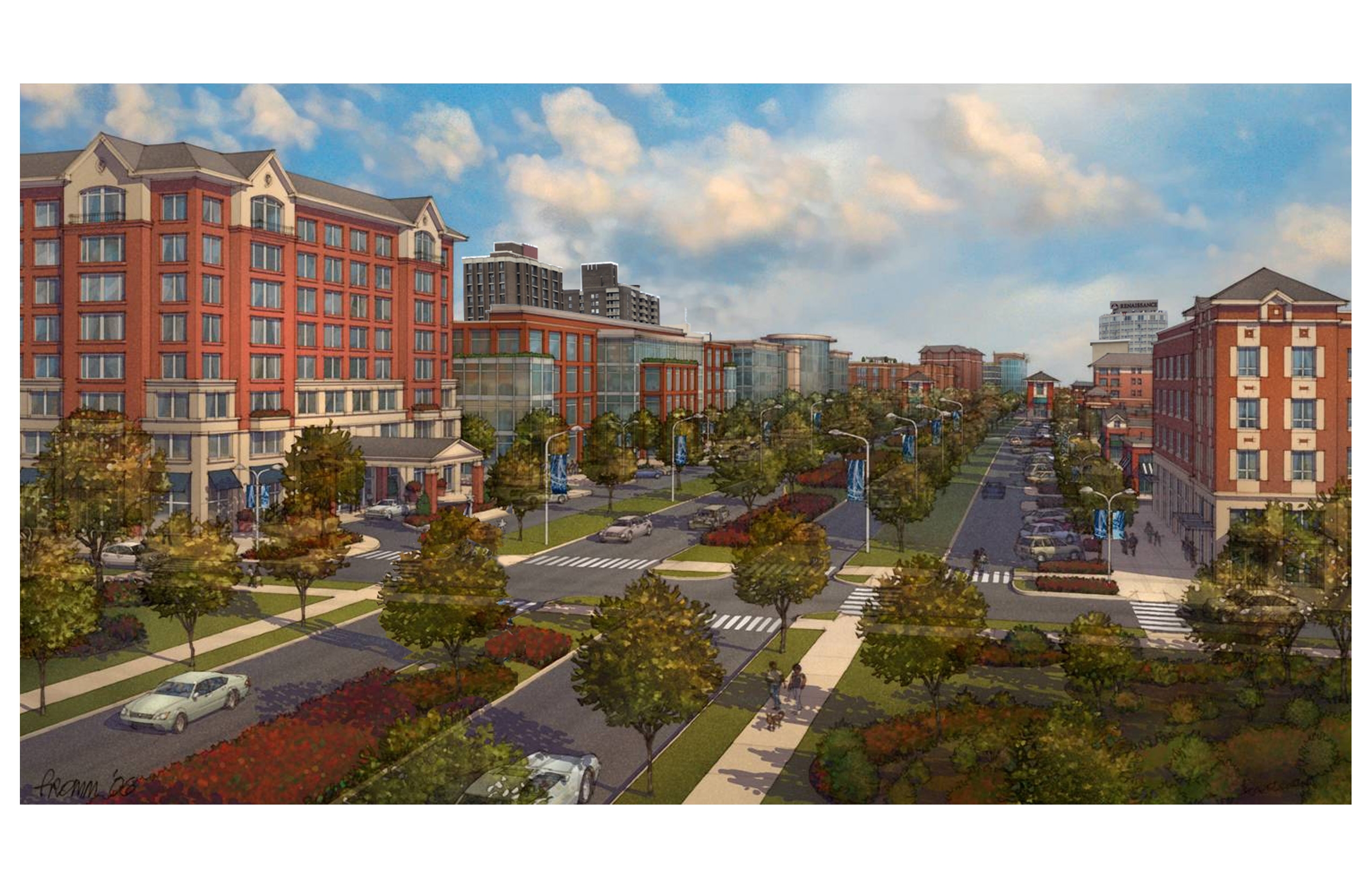
A proposal for transforming the 1940s Iberville complex in downtown New Orleans into a denser mixed-income neighborhood, hinges on removal of  I-10, an elevated highway, which in the 1960’s replaced Claiborne Avenue, a broad tree-lined boulevard that was then a bustling African-American commercial strip.  An article published this week in the New York Times Critic’s Notebook column highlights the project, and the idea, first proposed by the Congress for the New Urbanism, to replace the elevated expressway, with an at-grade urban boulevard.  The city received a federal grant of $2 million last October to study the teardown option.

CNU’s report states that “Demolition of the aging elevated expressway would remove an eyesore that has dominated and damaged the Tremé/Lafitte landscape for almost 50 years and held back serious attempts to spur economic development. The destruction of the oak-lined avenue and construction of the elevated expressway in the 1960s, was intimately tied to the overall decline of Claiborne’s surrounding neighborhoods and occurred against the wishes of the area’s largely disenfranchised African-American residents….”

The full report, “Restoring Claiborne Avenue”, released in July 2010, concludes:  

The real benefits of removing a downtown urban freeway borne out by several cases of urban freeway deconstruction in New York City, San Francisco and Milwaukee. Among the key lessons from these case studies are:

o Traffic is adaptable.  Urban traffic (i.e., drivers of motor vehicles) is highly adaptable and will divert to the best route available, especially when there is a highly connected grid of streets. When a high‐speed urban freeway is available, traffic is drawn to that corridor due to the higher speeds. In cities that have experienced a freeway removal, either planned or through a catastrophe, traffic has quickly adapted and redistributed itself to other routes.
o Economic benefits result from removing elevated freewaysThe localized economic harm that has resulted from the Claiborne Expressway is obvious, documented by the low property values and decline that the corridor has experienced since the freeway was constructed. Several compelling recent projects show the great benefit that can result by removing elevated freeways and replacing them with well designed, multimodal urban streets.

“Highway Removal” Project in Cleveland Looks an Awful Lot Like a Highway

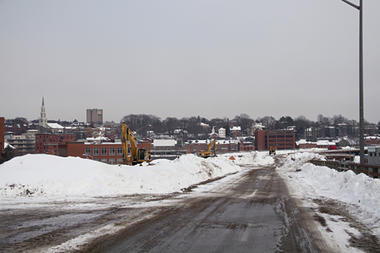
According to the March 23, 2011 Streetsblog , NPR didn’t get it quite right in reporting that Cleveland is replacing a freeway with a tree-lined pedestrian-friendly boulevard a la the Embarcadero in SF or Park East in Milwaukee.  Although the elevated freeway is coming down, the ODOT has reportedly nixed a reduction of the speed limit from 50 to 35 mph and the placement of traffic lights and pedestrian crossings – planners say they would add 70 seconds to commuters’ travel time – relegating pedestrians and bicyclists to underground tunnels to reach the park on the shores of Lake Erie.

This sounds a lot like Buffalo’s Experience with NYS DOT and the Outer Harbor Expressway that separates Lake Erie from downtown http://oclblog.wordpress.com/2008/09/30/rethinking-i-81-ocls-study-blog-3/.  The elevated, limited-access Route 5 restricts access to the lakefront and limits development potential according to opponents, but DOT rejected calls for an at-grade boulevard.

Gridlock! Traffic! Crying Wolf in Seoul

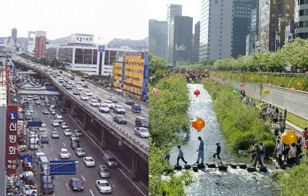
What would happen if they took out what was considered a vital traffic artery carrying 168,000 cars per day? Lots! Improved travel time, improved environment, increased property values, more public space, revitalized central business district.

 Kamala Rao, MCIP, Transportation Planner in Vancouver, BC, and a Sightline board member, profiles Seoul’s success story of urban highway removal at Sightline Daily.

Photo from http://www.preservenet.com/freeways/Seoul_BeforeDongdaemunArea.jpg and http://www.vector1media.com/spatialsustain/koreas-urban-sensor-web-test-projects.html

More Cities are Razing Urban Highways

Removal of aging highways is a strategy some cities are using to try and boost their downtown districts http://www.csmonitor.com/USA/2011/0302/Downtown-need-a-makeover-More-cities-are-razing-urban-highways – Christian Science Monitor

By Jeremy Kutner, Correspondent / March 2, 2011
New Haven, Conn. In New Haven, Conn., a mistake of the past – one that displaced hundreds, razed a neighborhood, and physically divided a city – is finally set to be rectified: A highway is going to be demolished.

Some people in New Haven have been waiting to see this for 40 years, ever since it became clear that a modern roadway slicing through the heart of downtown would not bring the hoped-for suburban shoppers and revitalization. That waiting list is long, it turns out, as cities across the United States look to erase some of the damage from urban highway construction of the 1950s and ’60s – tearing up or replacing the roadways and attempting to restitch bulldozed neighborhoods. ….

In Providence, Rhode Island transportation officials opted to reroute a dilapidated section of highway, moving the road Some people in New Haven have been waiting to see this for 40 years, ever since it became clear that a modern roadway slicing through the heart of downtown would not bring the hoped-for suburban shoppers and revitalization. That waiting list is long, it turns out, as cities across the United States look to erase some of the damage from urban highway construction of the 1950s and ’60s – tearing up or replacing the roadways and attempting to restitch bulldozed neighborhoods.outside the downtown core at no small expense. Demolition began late last year.

Now, “there’s an opportunity not only to create a new neighborhood but to sort of reinvent our downtown,” says Robert Azar, a planner with the Providence Department of Planning and Development….”

Chicago’s Lawrence Avenue to Get a Trim

THE ARCHITECT’S NEWSPAPER
02.21.2011
Chicago’s Lawrence Avenue to Get a Trim
Planned ‘road diet’ will bring bike lanes, street trees, and pedestrian amenities to major commercial corridor

Lawrence Avenue east of Western Avenue will include curb extensions with bioswales and pedestrian refuges.
Courtesy CDOT

Crossing the street in Chicago is about to get a little easier. The Chicago Department of Transportation (CDOT) plans to start trimming the excess off four-lane Lawrence Avenue on the North Side. It will be the first busy thoroughfare to be altered as a result of a complete streets policy adopted in 2007, in favor of a more balanced approach to road design that considers pedestrians, cyclists, transit riders, as well as drivers.

Placing oversized streets on a so-called “road diet” has already been tested on at least ten of Chicago’s residential streets in recent years, but with the upcoming repaving project on one of the city’s busy corridors, the time is right to take the concept mainstream.

A mile-long stretch of Lawrence Avenue between Western and Ashland avenues with four travel lanes will be cut to three with full bike lanes and wider sidewalks. Janet Attarian, a streetscape project director at CDOT, said a few targeted changes will go a long way toward improving a neighborhood. And providing opportunities for sidewalk dining with new benches, lighting, and 150 new trees should make heavily trafficked Lawrence far more appealing.

Adolfo Hernandez, director of outreach and advocacy at the Active Transportation Alliance, agrees. His organization undertook a walkability study after a string of pedestrian and cyclist injuries, presenting their findings to the city’s aldermen, who requested CDOT take on the project.

Lawrence Avenue West of Western Avenue.

New street trees and a bike lane are included on Lawrence Avenue west of Western Avenue.

“We’re not minimizing the role of the car,” Hernandez said of removing lanes. “We’re balancing multiple modes of transportation.” Still, Attarian says car travel will be effected. “We’re not going to deny it has an impact on traffic, but it brings a better pedestrian environment.”

Increased walkability is expected to be an economic boon, as well. According to Hernandez, businesses along walkable streets tend to do better and see higher foot traffic than roads geared solely to the car. “Moves like this can push a place to the tipping point.”

Lawrence Avenue’s current layout presents undeniable challenges. “Whenever you have a fast-moving, wide road, it’s going to act as a barrier,” Attarian said. She hopes the improvements will also help connect the corridor with recent streetscape improvements on nearby Lincoln Avenue.

Instead of flash swamps at the corner, curb extensions with bioswales to capture rainwater runoff will narrow the street at crosswalks, along with pedestrian refuges in the central turning lane, that should further increase pedestrian safety.

Including bioswales in the bumpouts actually saves money, Attarian explained. One cost typically overlooked when narrowing a street is relocating catch basins. The swales allow basins to remain in place inside new planters.

East of Ashland, Lawrence currently contains only two travel lanes, but will still undergo a similar slimming treatment. Sidewalks will be extended to accommodate 100 new shade trees and allow for al fresco dining.

The city is now completing the streetscape design for Lawrence Avenue, and the road diet will be realized in two phases over the next several years. Funds are being sought, and the final project is expected to cost between $14 and $20 million.

For local advocates, Lawrence Avenue is just the beginning. “We’re pretty excited that there seems to be a more balanced approach to road design,” Hernandez said. “Lawrence Avenue is a really nice start.” Cars have been king of the road for too long, he said: “We’re moving in the other direction.”
Less Congestion, More Sprawl

More on the irrationality of current traffic congestion measures, from Gateway Streets, a St. Louis blog:

Work continues on 141 between Olive and 364. Credit: modot_stl_photos.

“… a closer look at the data in the Urban Mobility Report reveals a puzzling fact: despite reduced congestion on the region’s roads, commutes in St. Louis are getting longer than ever before. Peak hour commuters spent an average of 289 hours behind the wheel in 2009, 36 hours more than in 1999 when congestion was significantly worse. In fact, according to the UMR report, St. Louis has the 5th longest commutes among metro areas over 1 million population (Los Angeles and New York, bafflingly, are ranked 22nd and 33rd, respectively). How is it that that commuting times get longer as congestion decreases?

The answer to the puzzle, of course, lies in the sprawling nature of St. Louis’s suburbs. Between 1950 and 2000, St. Louis’s urban population grew 48% while urban land area grew over 260%.

St. Louis’s extensive highway network may be partially to blame for the region’s sprawl. As pointed out by the Urbanophile, St. Louis has the 3rd most freeway lane miles per capita amongst metro areas over 1 million in population ….”

Driven Apart

As The I-81 Challenge –  official decision-making process led by two entities, the New York State Department of Transportation and the Syracuse Metropolitan Transportation Council (SMTC), the region’s metropolitan planning organization (MPO) – gets into gear, the Rethinking I-81 blog will reopen for comments.   

Driven Apart: How sprawl is lengthening our commutes and why misleading mobility measures are making things worse – “A new report from CEOs for Cities unveils the real reason Americans spend so much time in traffic and offers a dramatic critique of the 25 year old industry standard … often used to justify billions of dollars in expenditures to build new roads and highways.

“The report recommends a new system for measuring urban transportation performance that includes emphasizing accessibility and focusing on measures of land uses, trip lengths and mode choices as well as travel speeds”.


“Rethinking I-81”: OCL’s Study Blog

Making Streets Behave

New York City has issued its first street design manual, in an effort to make streets more environmentally friendly, and more amenable to bicyclists and pedestrians.  Urban planners see the document as a blueprint for designing the infrastructure for a 21st century city – one that thinks about streets as “…not just thoroughfares for cars, but as public spaces incorporating safety, aesthetics, environmental and community concerns.”  The guidelines help developers, both public and private, know what is expected of them throughout the five boroughs.

Here is what the manual says about itself:  The Manual builds on the experience of innovation in street design, materials and lighting that has developed around the world, emphasizing a balanced approach that gives equal weight to transportation, community and environmental goals. It is designed to be a flexible document that will change and grow, incorporating new treatments as appropriate after testing. The use and continued development of the Street Design Manual will assure that New York City remains a leading innovator in the public realm as it becomes a greater, greener city.

“Rethinking I-81”: OCL’s Study Blog

No ‘Carmageddon’ in Times Square

In a move to create a smoother traffic flow and more pedestrian-friendly environment, the NYC Department of Transportation shut down parts of Times Square to traffic.  On Tuesday, two days after Broadway was closed to traffic between 42nd and 47th Streets, cars, trucks, taxis and other vehicles still flowed as usual on Seventh Avenue.  The city closed sections of Broadway on Sunday, creating a pedestrian mall that extends to Herald Square.

The bottlenecks and ‘Carmageddon’ that were predicted failed to materialize, not even on Tuesday, the first workday without cars.   Even 48th Street, “where cars now have their last chance to jog over to Seventh Avenue before reaching Times Square” …. “appeared largely trouble-free”.   (While midtown workers and pedestrians are pleased, delivery truck drivers are not happy with the experiment that requires them to park farther from their destination).

The experiment is part of the plan of Mayor Michael Bloomberg and his transportation commissioner to ease dangerous traffic congestion in the area. Whether the Mayor decides to suspend the traffic rerouting or to continue or even extend it farther along Broadway, for now it is another example of the adaptability of drivers and the power of the street grid to absorb traffic.